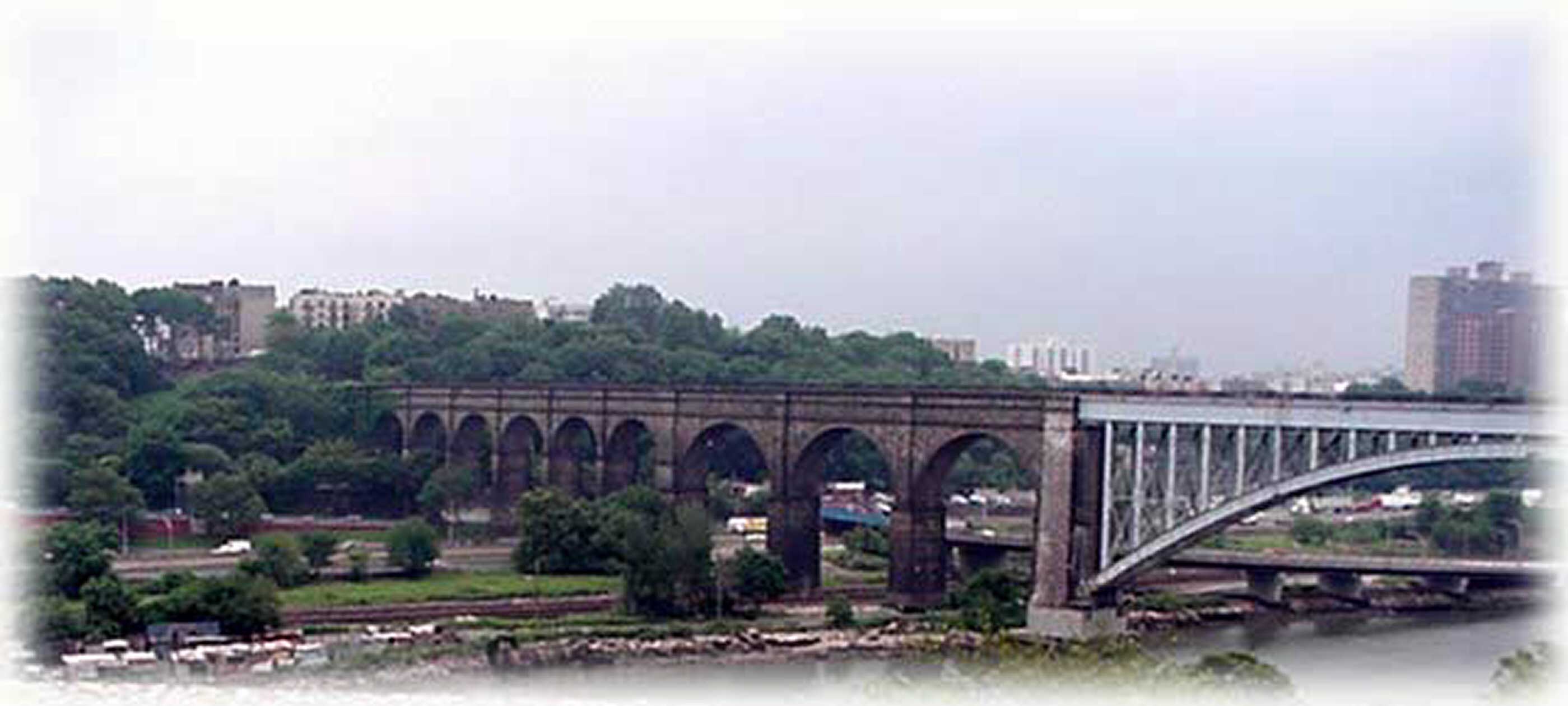
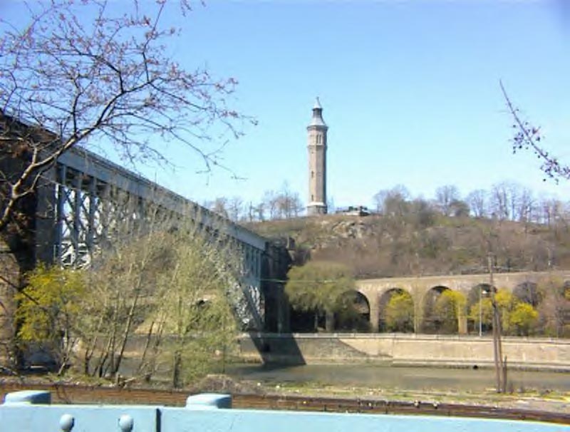
Highbridge photo taken 6/22/2001 by Susan Casey
Highbridge
photo taken 6/22/2001 by Susan Casey
![]()
Click
on pictures for enlarged version then
use your browser's back arrow to return to this page
Don't forget to turn up your sound to hear background music
|
|
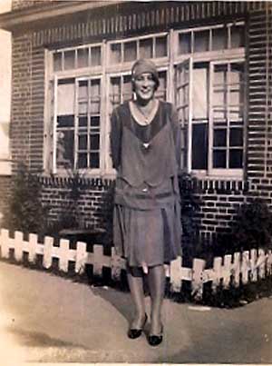
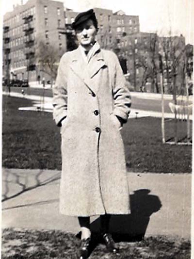
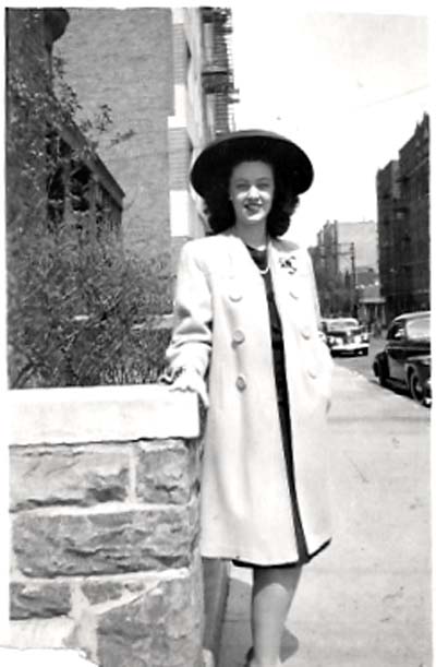
This is my mother standing in front of 1060 Anderson Ave. |
|
|
|
|
|
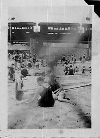
Remember the Cascades Pool on Jerome Ave.? Notice the Old Train on the El? |
|
|
|
|
|
Our house "1139 Anderson Ave" circa late 1920's |
|
|
|
|
|
This is a view of the house while still under construction. Notice the top of Anderson and the tip of that old house that used to be there. I think we called it the Brown's House because it used to be part of a farm owned by the Brown family. This picture must have been taken around 1907 when my grandfather had the house built. |
|
|
|
|
|
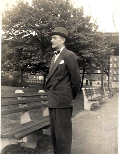
My uncle at Jerome Park (at least that is how we referred to it) |
|
|
|
|
|
On the steps of upper porch of our house, notice the background. There are no buildings built there yet. This is around 1923 |
|
|
|
|
|
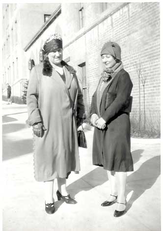
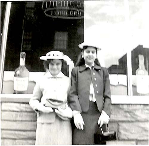
My grandmother with my aunt standing on the east side of Anderson in front of the big apartment houses just off of 167th St. |
|
|
|
|
|
This is the small private house just across the street from mine on east side of Anderson at the bottom of the hill. The apartment building which was next to it was not built yet. |
|
|
|
|
|
This is the same house as I mentioned above. The private homes next to it were long gone by the time I was around. In their place was a big apartment house. |
|
|
|
|
|
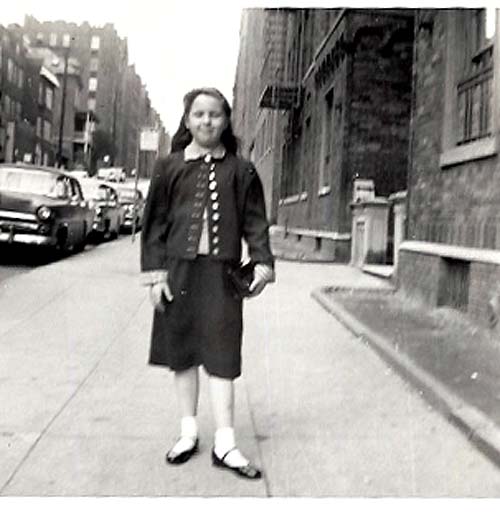
My mother on the stoop of house on corner of Nelson Ave. and 166th St. right across from the Methodist Church. My grandmother Mary McGowan lived there |
|
|
|
|
|
Another shot facing east on Anderson and 167th St. |
|
|
|
|
|
Bottom of Ogden. This was taken late 1920's |
|
|
Another shot on Anderson Ave. circa 1920's |
|
|
This looks like it is in front of my Aunt's house on 166th and Nelson but the background looks more like Woodycrest to me??? This picture was taken sometime in the 1940's |
|
|
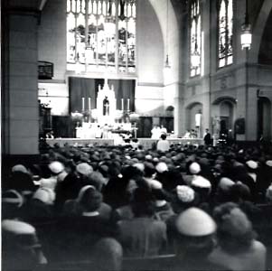
Picture of inside SH Church in the 50's. My confirmation was the occasion. |
|
|
About 1950. Sitting on the wall at Macombs, Yankee Stadium is in background |
|
|
Another shot of same site |
|
|
|
|
|
This picture is not clear but gives a view of the fountain at Macombs. |
|
|
My cousin Eddie Shalvey (my uncle Vinnie is in the background). This was taken across from 919 Ogden Ave. where they lived. |
|
|
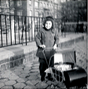
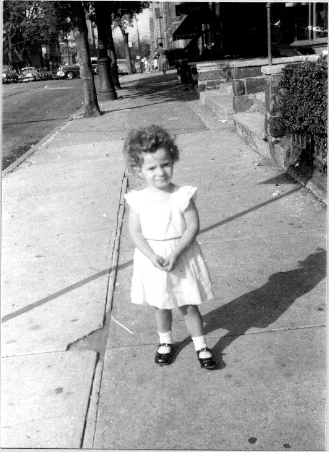
This looks like Ogden Ave facing North. The little girl in the picture lived next door to us at 1145 Anderson. |
|
|
Again at the bottom of Ogden. This time in 1959 |
|
|
|
|
|
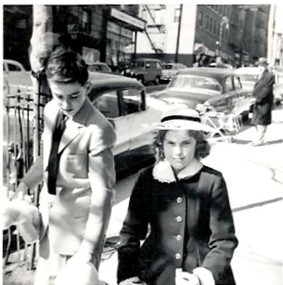
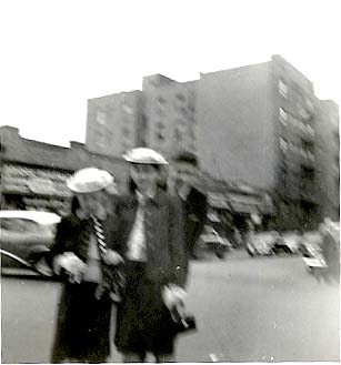
Facing north on Anderson Ave. towards 167th St. The girl in the picture is Ramona Lopez. |
|
|
|
|
|
In front of Sam's Bar and Deli on 167th Woodycrest. |
|
|
|
|
|
This is not a very clear picture but you can somewhat see the stores on Woodycrest specifically Sam & Lou's candy store. |
|
|
|
|
|
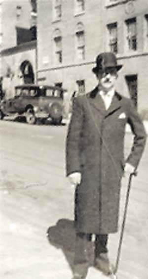
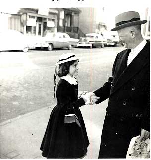
Can anyone tell me where this was taken? I remember that house in the background but not where it is located. And, no, that is not President Eisenhower, but a friend of my fathers, James Stapleton. lol |
|
|
|
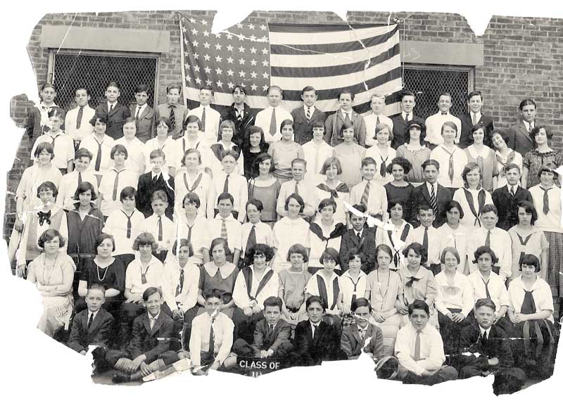 |
This is the class of '23' from PS 11. Sorry that it is so torn up. My mom is on your far right with the tie. Could anyone else's parents be in this picture? You never know. |
|
|
|
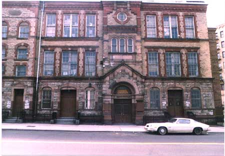 |
Just for comparison sake I am putting this picture of PS11 although it is on my other site. |
|
|
|
|
|
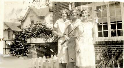
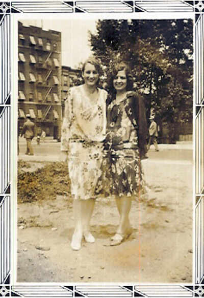
This is my mother standing with a friend (Grace Gilbert) in front of the old tennis courts on Woodycrest. They are on the Nelson Ave. side and behind them is the tennis courts and the apts on Woodycrest. The tennis courts later became the playground we are all familiar with. |
|
|
|
|
|
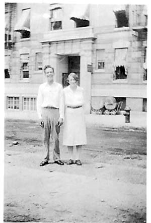
Again my mother with Grace Gilbert (older now) standing on the corner of 166th right off of Nelson Ave. It looks like they are standing on the spot of the tennis courts (now gone) but prior to the playground. |
|
|
|
|
|
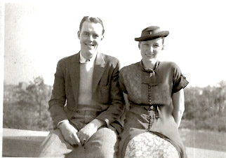
This is my father and it looks like he is sitting at Macombs Park. This is probably in the 1930's. |
|
|
|
|
|
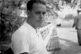
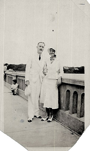
My uncle and a friend standing on the Washington Bridge or Highbridge? |
|
|
|
|
|
This looks to be taken from Macombs facing North |
|
|
|
|
|
I am not sure where this picture is taken. It could be at the park at the base of Ogden. |
|
|
|
|
|
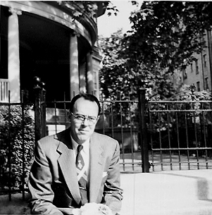
My Father sitting in front of the Bunck House on 164th and Woodycrest. Taken in the 1950's |
|
|
|
|
|
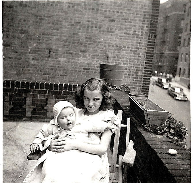
Sitting on my sister's lap on upper porch of our House on Anderson. You can see some of Anderson in the background and the boys that used to play stickball there sitting on corner |
|
|
|
|
|
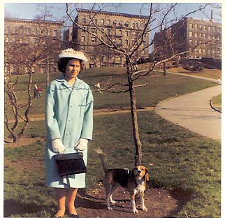
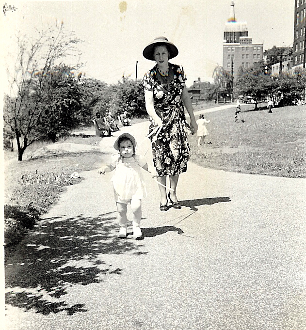
My mother taking me for a walk at Macombs. Notice the Wilson building in the background? |
|
|
|
|
|
This picture is of my cousin in front of 1040? Woodycrest. This building used to be located right on the corner of 167th and Woodcrest adjacent to Sam's Deli. You can't see much of it but I wanted to put it here because the building is now gone as many are on Woodycrest Ave. |
|
|
|
|
|
I am pretty sure this is on Woodycrest and 166th St. right in front of the Playground. Can anyone verify this for me? |
|
|
|
|
|
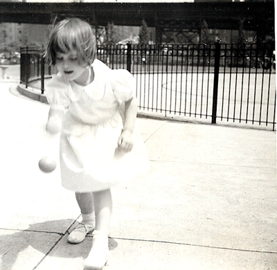
In front of the ever so deep wading pool down at Jerome Park |
![]()
| This is an old pamphlet from the HB library that my mother saved. |
|
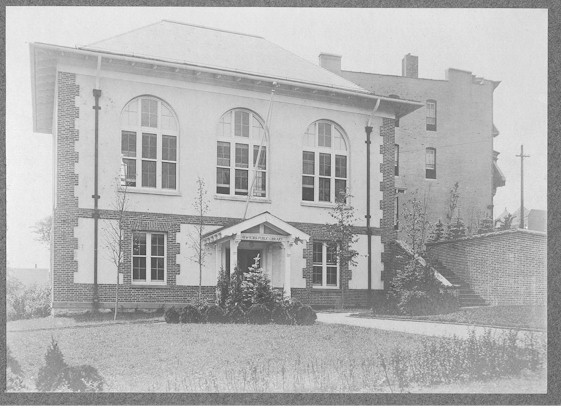
The
branch has been a part of the community since 1901 when its first
charter was granted. The High Bridge Free Library, as it was then
called, started in Realty Hall at Merriam and Ogden Avenues. In
1897 and 1901, two important library events occurred in New York City:
The New York Public Library contracted to provide service in Manhattan,
the Bronx, and Staten Island; Andrew Carnegie gave $5,200,000 for
library buildings. Thus, in 1907, the ‘Free Library’ was transferred
to the New York system, and, in 1908, moved into its new quarters. It
was the fourth of the system’s branch libraries to be established in
the Bronx. The
two-story Dutch colonial building opened with 5,000 books. It served its
quiet residential neighborhood well until the 1920’s when apartment
houses sprang up everywhere bringing thousands of newcomers; In 1933, an
extension, which doubled the size of the old library, was added and the
book collection expanded to 19,000. An interior renovation in 1956
resulted in a new decor, modern lighting and equipment, and other
improvements. ORIGINALLY
INDIAN TERRITORY, the High Bridge neighborhood \vas part of a tract
called Keskeskeck, purchased from the Indians by the Dutch West India
Company on August 3, 1639. One
of the first settlers there was Daniel Turneur, who in 1671 bought an
80-acre parcel. Confirmed by an Indian deed of May 10, 1676, the land
corresponded roughly with the present High Bridge area and lay between
the Harlem River and, as the Dutch knew it, Maenippis Kill. Called
Mentipathe by the Indians, the Kill was renamed Cromwell’s Creek about
a century later for James Cromwell, a miller who worked for General
Lewis Morris in the 1770’s. Jerome Avenue (formerly Central Avenue)
now follows in part the bed of the filled-in creek, while Cromwell
Avenue retains the original family name. Although
Turneur owned most of the low land and meadow along the Mentipathe, a
farmer named Bickley lived on the hill west of the creek. One Frederick
Devoe subsequently married Turneur’s daughter, the Bickley farm was
added to the Turneur property, and the Devoe family then owned all the
land south of about West l67th Street. The
Indians called the area Nuasin. Later it was referred to as Turneur’s
Land, and finally, as Devoe’s Point or Neck. Little change was seen in
the Point until nearly the middle of the 19th century when a
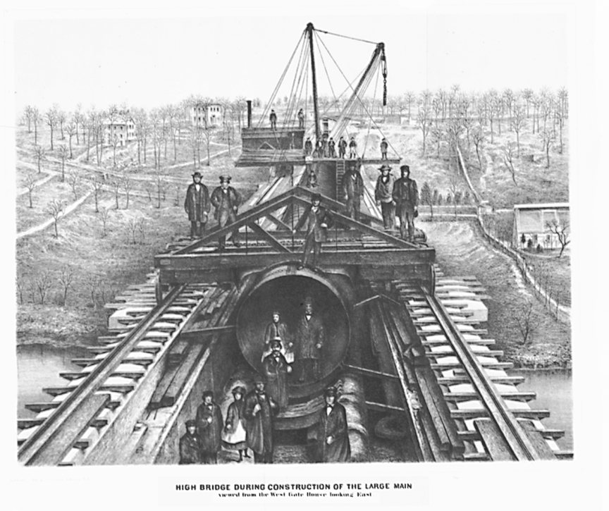
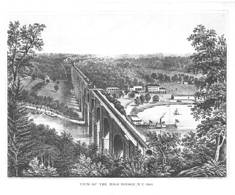
major engineering project was undertaken by New York City. The
decision to make the Croton River a new source of New York’s water
supply necessitated the construction of a huge aqueduct. Since an
earlier court action protected the navigability of the Harlem River, the
section of the aqueduct crossing the Harlem was supported by a
pedestrian bridge high enough to permit boats to pass. Begun in August,
1839, the “high bridge” carried “ carried water on July 4, 1842,
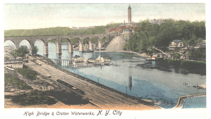
even though construction continued until 1848. The
original granite bridge was 1,450 feet long with 15 semi- circular arches 100 feet high. In the early 1920’s
a single span of steel replaced the stone piers in the bed of the river
to allow for increased navigation on the Harlem. During
the years of bridge construction, a hamlet grew up at the Bronx end of
the new aqueduct. The community took its name from the bridge, and
beginning in the l840’s, the neighborhood extending along Devoe’s
Neck as far as Macomb’s Dam Bridge was known as Highbridgeville, later
shortened to High Bridge.
The
shopping center of the village was at Ogden Avenue and West 167th
Street, where a general store, Spellman's Tavern, a dry goods store, and
other establishments were located. The old tavern still stands as
do a few early homes and gardens. The early 1900's saw High Bridge young people sleigh riding, ice skating on Cromwell's Creek near P.S. No.114, attending strawberry festivals and May parties, minstrel shows and lantern slide lectures in old Realty Hall. Years have passed and the old homesteads and mansions had disappeared along with the orchards and stone walls separating pastures. But High Bridge, New York City's oldest bridge, continues, to supply the city with 24,000,000 gallons of water a day.
|
![]()
|
Old
clippings from the Sunday News
|
![]()
|
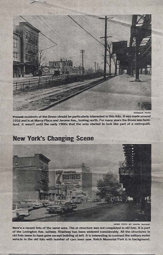
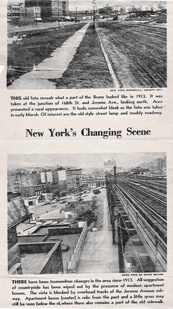
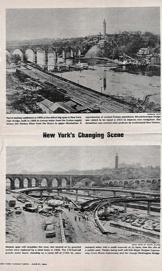
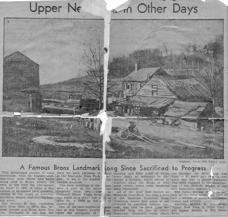
This
old article is pretty beat up but I
|
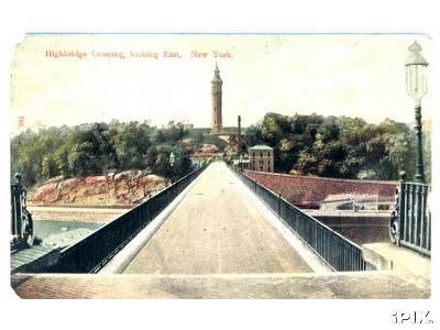
![]()
Some
more shots of High Bridge
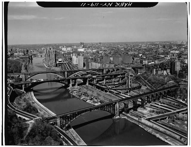
most of these are from the Library of Congress website


![]()
These pictures are from Mike Daly. Thank you Mike

![]()
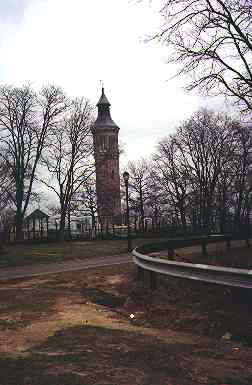
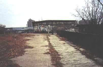
I don't remember where I got these pictures but they are the
Highbridge Water Tower and entrance onto the Highbridge
walkway which has been long closed up.
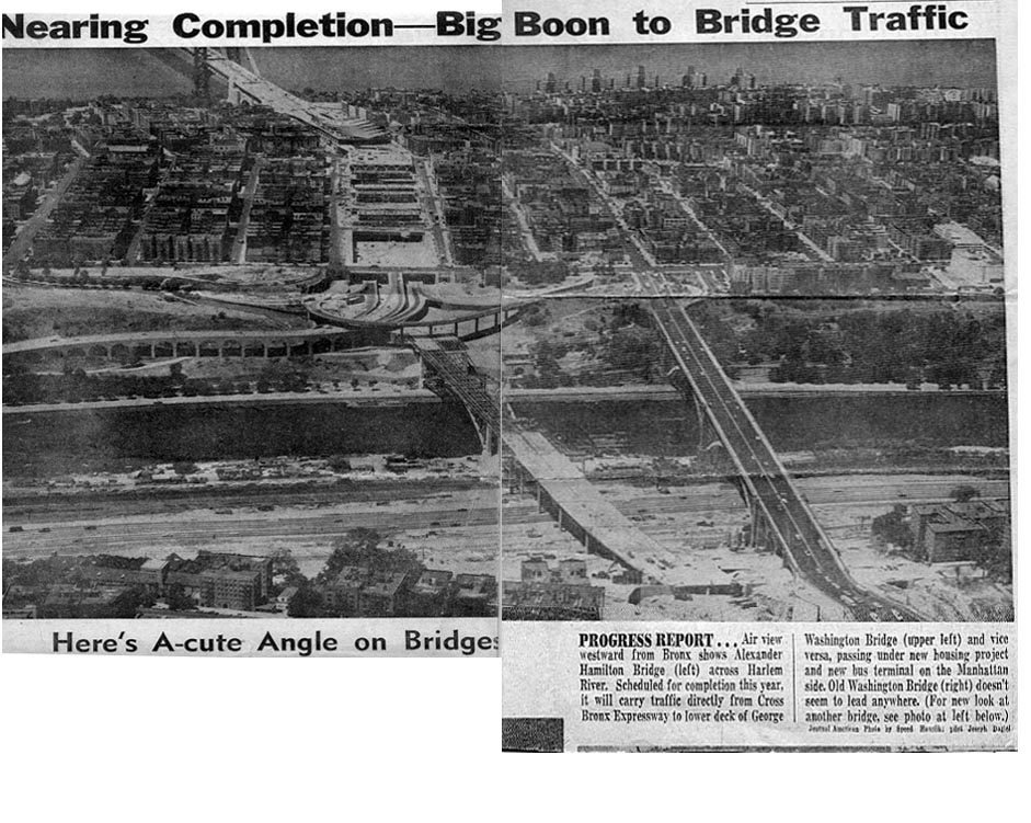
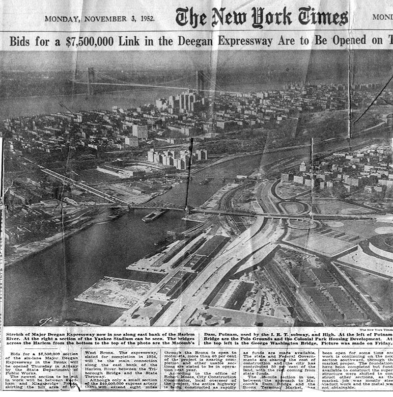
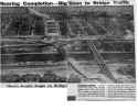
Some More Old News Articles
regarding the construction of the Alexander Hamilton Bridge
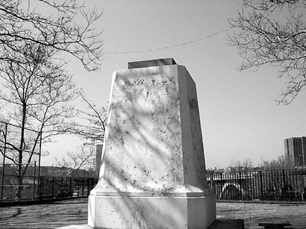
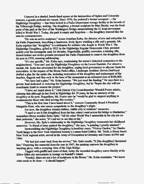
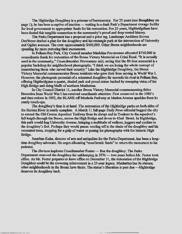
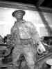
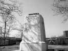
Our Lost Doughboy
This is a picture of the Doughboy statue standing in a storeroom
waiting to be restored and reinstated onto his base (picture below)at
the intersection of Ogden and University Aves.
***********
These pictures and following articles were sent to me
from Denae Brewer of the Highbridge Horizons Newspaper
![]()
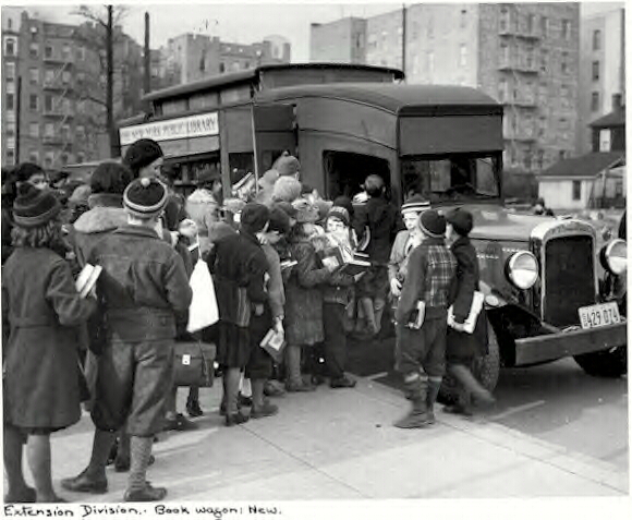
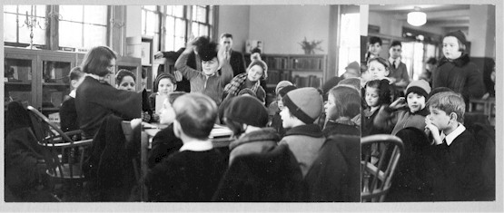
Remembering
our old Library and the traveling
library in the Bronx


![]()
ANOTHER
OLD ARTICLE
click on image to enlarge
|
|
![]()
Some
more memorabilia
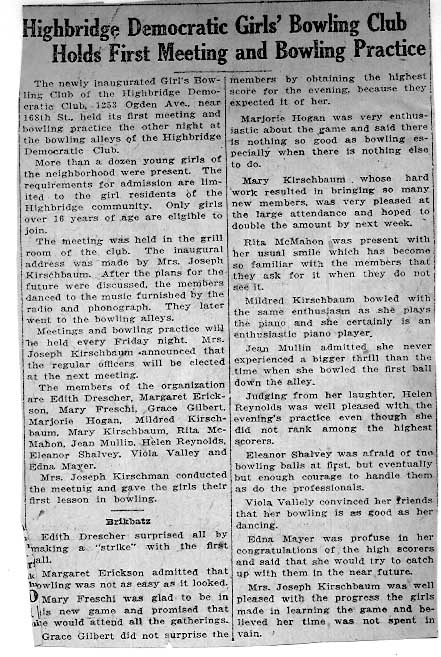
My mother actually saved this in her scrapbook
She used to commute when attending
The College of Mt. St. Vincent
Wow!!!
This is a great site for old train buffs
Lots of pictures are here
![]()
http://www.nycsubway.org/irt/irt-els/9th-ave-el.html
More stuff my mother saved!!! Would you believe????
![]()
![]()
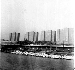
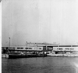
A couple of Highbridge views
taken from the Circle Line Cruise
![]()
Click
here to go to the Baby Years
Click
here to go to the Older Years

Click
here to see HB today
Click
here to see 2001 Reunion Pics
Feel Free to Sign My Guestbook

Counter: hits!